Hydrometric data monitoring and collection at Ok Tedi Mining Limited (OTML) will now be efficient and accurate with the completion of the Hydrometric Network Upgrade Project in September.
The project began in January of 2015 and involved the replacement of 22 old hydrometric stations and construction of new ones at strategic locations in the headwater catchments and along the Ok Tedi and Fly River channels.
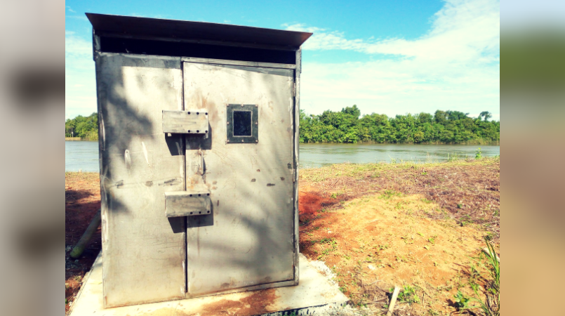
These stations will monitor and collect hydrometric information needed to support OTML operations; such as shipping and the Bige Dredge Operation by providing hydrometric data such as rainfall, river level, river flow/ flow rates, temperature, humidity, wind speed, wind direction and solar radiation.
Three additional hydrometric stations have been set up and one of these, Ok Birim, is strategically important to OTML operations in terms of providing flood warning to the dredging operation.
In addition to boosting the hydrometric services provided by OTML’s Environment Department, it is expected to provide reliable service for at least seven years, safeguard the future quality of hydrometric data collection and allow data users to access real-time data through the company’s intranet and even the internet.
All data transmission, which were previously operated via radio network, whereby data captured in the data loggers were downloaded quarterly, are now transmitted instantaneously via satellite telemetry system.
Manager Environment, Jesse Pile, said while challenges were encountered during the implementation with logistics, manning constraints, unplanned delays and landowner disagreements, the support from other OTML departments and contractors, coupled with outstanding project management by the industrial sites and water management team, resulted in the successful completion of the project.
(River level and rainfall monitoring station at Kuambit located downstream of Fly River and Ok Tedi River confluence)